Skip to main content The #1 agentic semantic tool search: 91.6% first-try accuracy on S1 Search Bench Explore Tool Discovery
Connectors Google Maps
Live 41 Actions

Google Maps Integration for AI Agents

Connect your AI agent to 41 Google Maps actions via MCP, A2A, or SDK, with agent authentication, tool-calling execution, and security built-in.


StackOne
DrataGPLocalyzeFlipMindtoolsScreenloop

Google Maps AI Agent Actions

41 production-ready actions for your agent to do more on Google Maps.

41 Actions
Validate Address - Validates an address.
Provide Validation Feedback - Feedback about the outcome of the sequence of validation attempts. Should be the last call made after a sequence of validation calls for the same address, sent once the transaction is concluded.
Render Aerial View Video - Queue a US postal address for aerial view video rendering or return existing video metadata.
Lookup Aerial View Video - Fetch a rendered aerial view video by address or video ID and return playback URIs when active.
Air Quality Current Conditions - Provides current hourly air quality conditions for a geographic location, including AQI values, pollutant concentrations, and health recommendations.
Air Quality Forecast - Returns hourly air quality forecast for a geographic location over a specified time range or single point in time.
Air Quality History - Returns hourly historical air quality data for a geographic location over a given time range.
Air Quality Heatmap Tile - Returns a bytes array containing the data of the tile PNG image.
Get Elevation - Retrieve elevation data (altitude above sea level) for locations or along a sampled path on the earth.
Geocode Address - Convert a street address or place name into geographic coordinates (latitude and longitude).
Reverse Geocode Coordinates - Convert geographic coordinates or a Place ID into a human-readable address.
Geolocate Device - Estimate a device location and accuracy radius from nearby cell tower and WiFi access point signals.
Create Tile Session Token - Request a Map Tiles API session token (UUID) that must be included in all 2D Tiles and Street View requests.
Get 2D Map Tile - Fetch a single 2D map tile image by zoom level and tile coordinates.
Get Photorealistic 3D Tile - Fetch a photorealistic 3D tile or root tileset JSON by tile path.
Get Tile Viewport Info - Query available zoom levels and imagery coverage for a geographic viewport bounding box.
Get Street View Tile - Fetch a single Street View panorama image tile by zoom level and tile coordinates.
Compute Insights (Area/Places Aggregate) - Retrieve insights about areas using filters such as area, place type, operating status, price level and ratings. Currently count and places insights are supported.
Place Photo (media) - Get a Place photo as a photoUri (skipHttpRedirect true) or as image bytes (default).
Text Search (Places) - Text query based place search.
Nearby Search (Places) - Search for places near locations.
Place Details - Get the details of a place based on its resource name, which is a string in the places/{placeId} format.
Autocomplete (Places) - Returns predictions for the given input.
Pollen Forecast - Returns up to 5 days of daily pollen forecast information for a geographic location.
Pollen Heatmap Tile - Returns a byte array containing the data of the tile PNG image.
Snap To Roads - Snap up to 100 GPS coordinates collected along a route to the most likely roads travelled.
Nearest Roads - Return the closest road segment for each of up to 100 independent GPS coordinates.
Compute Route Matrix - Compute a distance and duration matrix for all combinations of origins and destinations.
Compute Routes - Compute the primary route and optional alternates between an origin and a destination.
Solar Building Insights - Locates the building whose centroid is closest to a query point and returns its solar potential analysis.
Solar Data Layers - Gets GeoTIFF URLs for solar data layers covering a radius around a geographic location.
Solar GeoTIFF - Returns a solar imagery GeoTIFF raster by its asset ID.
Static Map Image - Fetch a non-interactive static map image (PNG, GIF, or JPEG) for a location, zoom, and size.
Street View Static Image - Fetch a static Street View panorama image (JPEG) for a location or panorama ID.
Street View Image Metadata - Retrieve metadata for a Street View panorama at a given location or panorama ID.
Get Street View Tile Metadata - Provides detailed information about the specified panorama, including the related address and links to adjacent panoramas.
Get Time Zone - Return the time zone and UTC offset for a geographic coordinate at a given point in time.
Weather Current Conditions - Returns the current weather conditions at a given geographic location.
Weather Daily Forecast - Returns up to 10 days of daily weather forecasts at a given location, starting from the current day.
Weather Hourly Forecast - Returns up to 240 hours of hourly weather forecasts at a given location, starting from the current hour.
Weather Hourly History - Returns up to 24 hours of hourly historical weather data at a given location, starting from the last hour.

Do More, Build Less

Integration Infrastructure for Google Maps AI Agents

Multiple Interfaces

Access integrations via API, AI SDKs, MCP & A2A.

Google Maps MCP server
Managed Authentication

Pre-built authentication UI.

Agent auth
Falcon Engine

Every Google Maps action runs on Falcon.

Agent Execution Engine
StackOne Defender
StackOne Defender Meta PG v1 Meta PG v2 DeBERTa 88.7% 67.5% 63.1% 56.9% Detection accuracy

88.7% prompt injection detection.

Prompt injection defense

"What impressed us most about StackOne is its ambition and clarity. They're creating infrastructure that modern software and the entire AI agent ecosystem can rely on. The depth of secure integrations, the pace of delivery, and the team's foresight into AI's future uniquely position StackOne to redefine this category."

Luna Schmid, Partner at GV

"We've been impressed by how quickly and deeply StackOne integrates with complex enterprise systems -- and now, with their focus on agent-to-agent interoperability, they're unlocking even more powerful use cases for customers. StackOne delivers all of the above in a universal layer -- without compromise."

Barbry McGann, SVP at Workday Ventures

G2 - High Performer G2 - Easiest To Do Business With G2 - Users Love Us G2 - Users Most Likely To Recommend G2 - Easiest Admin

Product Teams Love Building Agent Integrations With StackOne

G2

Google Maps AI agent integration resources
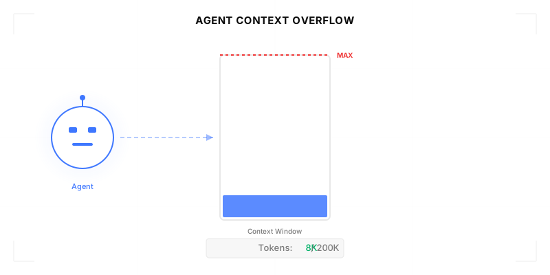
Agentic Context Engineering: Why AI Agents Kill Their Own Context Windows

AI agents exceed their context windows without knowing it. Six failure patterns and seven survival architectures for agentic context engineering.

15 min
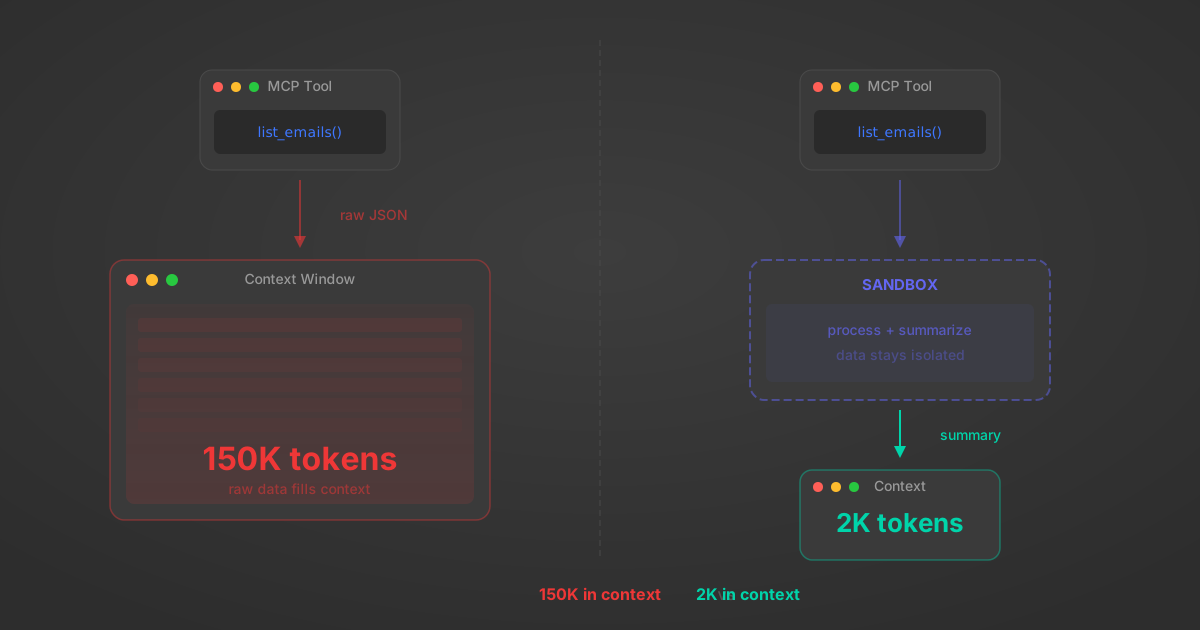
MCP Code Mode: Keeping Tool Responses Out of Agent Context

Anthropic's code_execution processes data already in context. Custom MCP code mode keeps raw tool responses in a sandbox. 14K tokens vs 500.

11 min
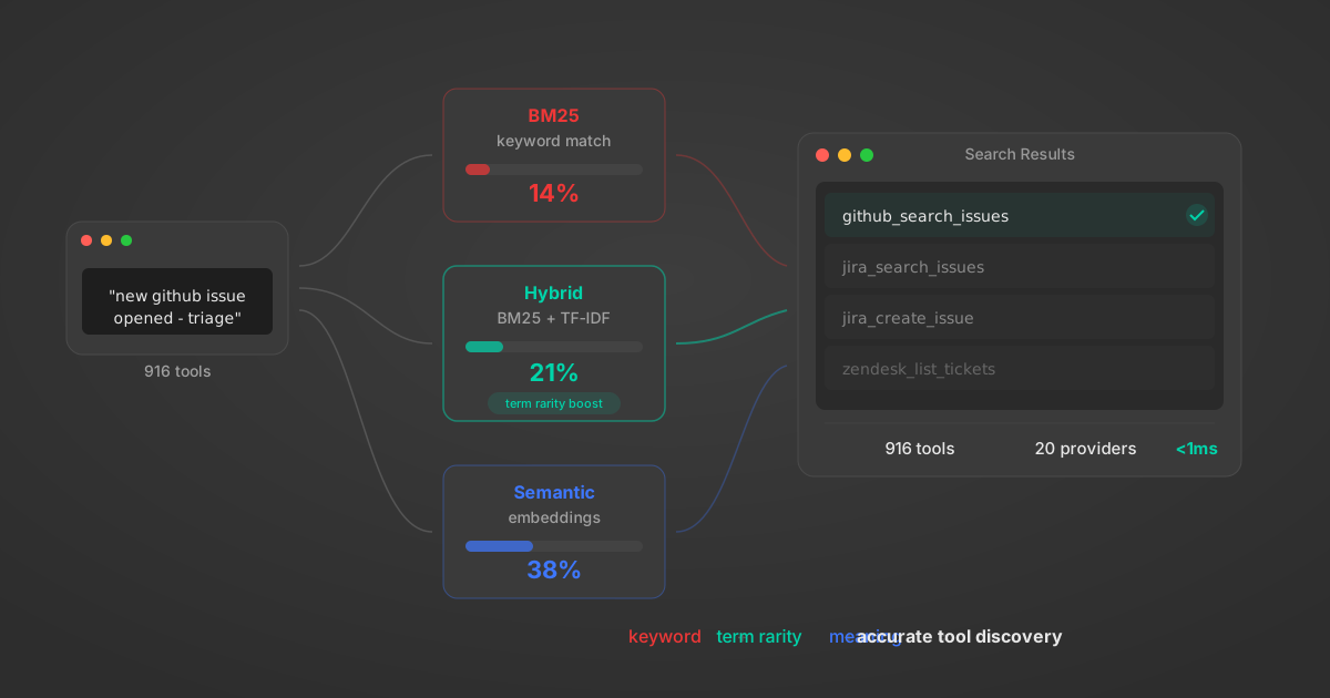
Comparing BM25, TF-IDF, and Hybrid Search for MCP Tool Discovery

Benchmarking BM25, TF-IDF, and hybrid search for MCP tool discovery across 916 tools. The 80/20 TF-IDF/BM25 hybrid hits 21% Top-1 accuracy in under 1ms.

10 min

Put your AI agents to work

All the tools you need to build and scale AI agent integrations, with best-in-class connectivity, execution, and security.